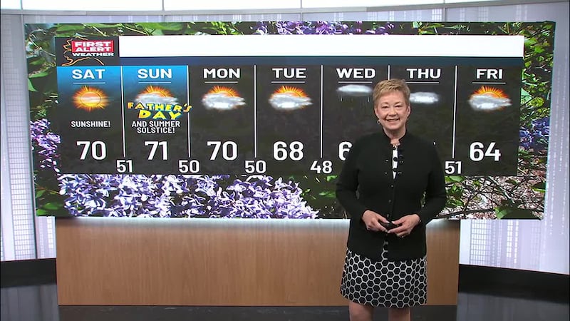
Perfect sunset conditions expected for Southcentral
ANCHORAGE, Alaska (KTUU) - If you’re in the southcentral region this week, the weather will provide some perfect picture opportunities for sunsets as blue sky and sunshine will dominate during the day. High pressure is building, and the region is expected to see clear skies for most of the workweek. Unfortunately, the temperatures will also be taking a plunge, so dress warmly if you’re going to be out and about. Overnight they will be falling into the single digits with teens for daytime highs.
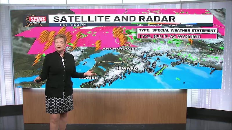
As the southcentral region basks in winter sunshine, the rest of Alaska will see some very active weather.
A Blizzard Warning is in effect from Point Hope to Point Lay and Utiagvik until Monday morning. Snow and blowing snow are expected with wind gusts to 65 mph. There’s also a Winter Storm Warning from 6 a.m. Monday into Tuesday morning from the south slopes of the western Brooks Range, Noatak Valley, Seward Peninsula, Upper Kobuk Valleys and Lower Koyukuk and Yukon Valleys inward to Galena. Heavy snow and gusty winds to 45 mph are expected.
In the Southeast, Juneau and the surrounding inner channels are under a Winter Storm Warning until 9 p.m. Monday. Heavy snow with a storm total of 25 inches is expected.
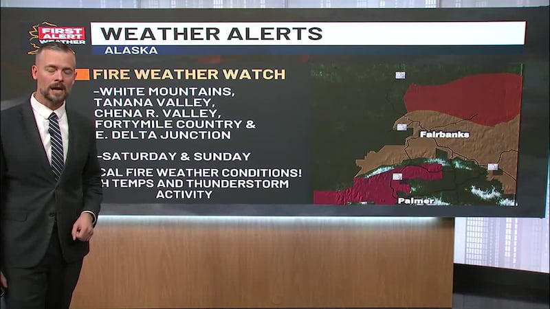
Other areas likely to see active weather in the form of snow include the Interior, and the lower Yukon-Kuskokwim Delta where mild temperatures are likely to produce snow and freezing rain.
Copyright 2024 KTUU. All rights reserved.