UAF Grad student works on project to better detect offshore earthquakes
ANCHORAGE, Alaska (KTUU) - A grad student at UAF is helping with an Alaska Earthquake Center project aimed at developing a new method for better locating offshore earthquakes that could be integrated into a possible future earthquake early warning system in Alaska.
“A lot of other places in the U.S. don’t have as many very large earthquakes that are coming from offshore sources like Alaska does,” Grad Student Cade Quigley said. “This is an issue that is not just unique to Alaska, but it is unique in terms of the United States.”
Quigley is working under his advisor and State Seismologist Michael West on the method, which they’re calling the Coastal Array Project.
He said the State’s push to establish an earthquake early warning system motivated the project, which is funded through a USGS award.
Earthquake early warning systems are not predictions. They instead send out an alert when a quake starts. The amount of warning someone gets depends on how close they are to the epicenter.
One earthquake early warning system called ShakeAlert is operational in some areas of the West Coast of North America. For Alaska, newly-approved federal funding will allow the first steps of implementation to start. It gives people near a quake a few seconds warning, and it can do things like shut off some gas line or open firehouse doors.
Alaskans do have access to an Android feature that gives early earthquake warning, but it is not a traditional system and uses people’s phones to pinpoint the shaking instead of scientific instruments.
The Coastal Array Project uses two seismic arrays that were installed in Kodiak and Homer in September and removed in November.
A seismic array is made up of many closely spaced seismometers, which are instruments that monitor earthquakes. In this case, each array was made of 26 seismometers within an area of about two kilometers.
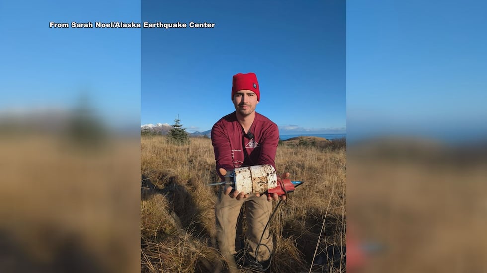
This project is looking to see if a seismic array, and what configuration of the seismometers can better pinpoint an offshore earthquake’s epicenter than traditional systems, which have seismometers every 20 to 50 kilometers or so, Quigley said.
Right now, seismometers are essentially faced in one direction when it comes to offshore earthquakes, Quigley said.
“Location triangulation all of a sudden becomes a lot easier if you have like a station in every single direction,” he said.
This method is also thought to better track an earthquake’s path as it happens.
“When we start talking about earthquakes on the scale, say like magnitude six, six plus, they are no longer just a single dot on the map. They are actually much larger rupture patches,” he said. “So, basically what a seismic array can provide is real time tracking of where that earthquake is moving over time.”
This information can tell scientists where the quake is moving while giving more detail on how big the event is and where the most shaking can be expected, he said.
Quigley said more accurately pinpointing where an offshore quake is happening can help scientists avoid creating public mistrust.
“If you mislocate where that earthquake is happening in this early warning system, you can end up sending a message to a community that is far away from shaking and that doesn’t actually need a warning,” he said.
But the flipside can cause problems too. If the earthquake is not pinpointed accurately, the warning may not go to the community that needed it.
“Both of these scenarios lead to mistrust in the system,” Quigley said. “We obviously want to be able to have a system that the community and public trust and works accurately.”
This isn’t the first time so many seismometers have been put in a similar configuration, but Quigley said it is usually for a different purpose, like monitoring a volcano.
He said other places, like Washington and Canada, are also doing similar tests with the intention of comparing results with each other.
“The technology is out there to be able to give Alaskans and people warning when an earthquake’s happening,” he said. “I think this project specifically is like making sure that when we end up having an early warning system sometime in the future, it’s like as accurate and true as possible.”
He said, ultimately, the Coastal Array Project will likely be an addition or an additional data point to further improve the ShakeAlert system.
He said the Coastal Array Project is still in the very early process of looking at how to integrate the arrays into our state.
“But I think it’s important to kind of be trying to be at the forefront of science,” he said.
They are looking to see if the arrays give high enough accuracy to be useful, but also what the best design might be.
“The goal of this is that we can try to see if we can get the best array possible with as few elements as possible, because obviously, things like this cost money,” he said.
Quigley said he hopes to have the final results in the next six to twelve months.
See a spelling or grammar error? Report it to web@ktuu.com
Copyright 2026 KTUU. All rights reserved.