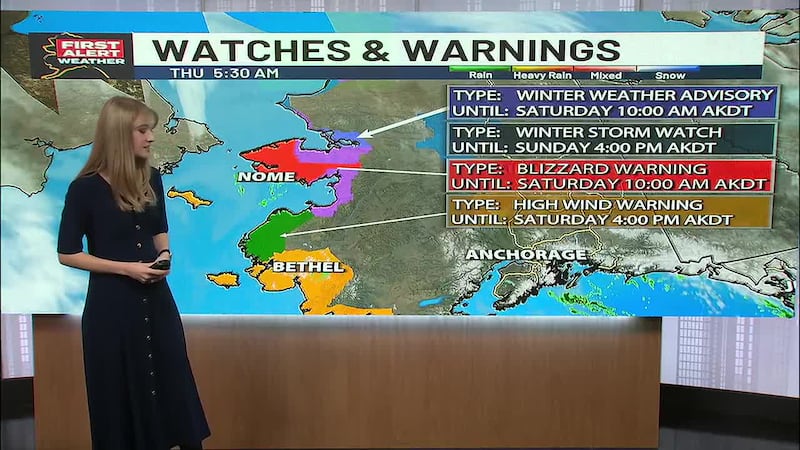
Very cold, potential for freezing fog in Anchorage; statewide storm systems move
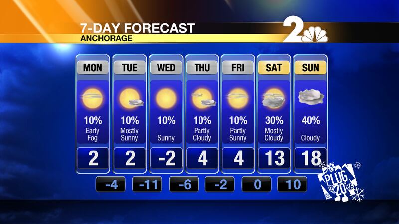
While under partly sunny skies Monday Anchorage will see a high near -2 degrees.
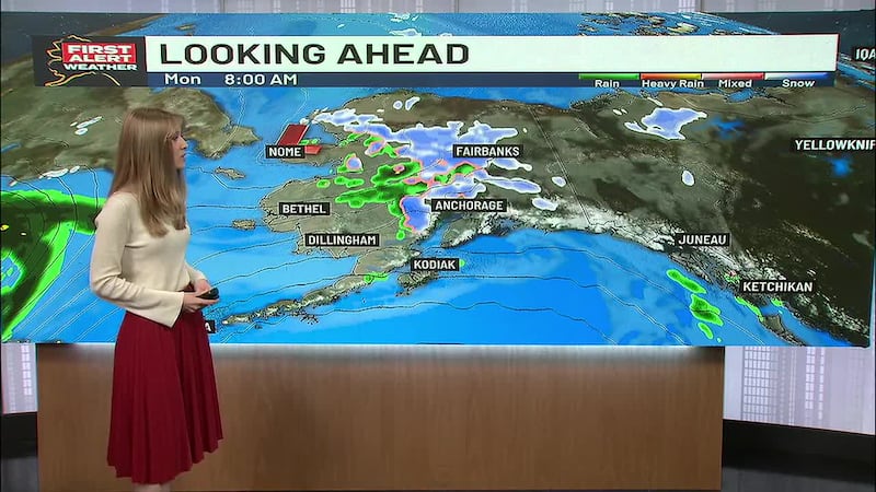
Snow from the northern Gulf will spread north from Valdez to Cordova with a few snow showers moving farther inland across the Copper River Valley. Patchy fog along the northern Cook Inlet persists through the morning but should improve during the day Monday with mid-level clouds spreading across from the west. Storm energy associated with a low will swing around the Interior, which looks to produce only a few flurries as moisture will be relatively low.
Airflow out of the Interior will increase as a low pressure system moves and strengthens toward the Gulf as winds and storm energy get pulled out of the northwest while this system spins and moves closer.
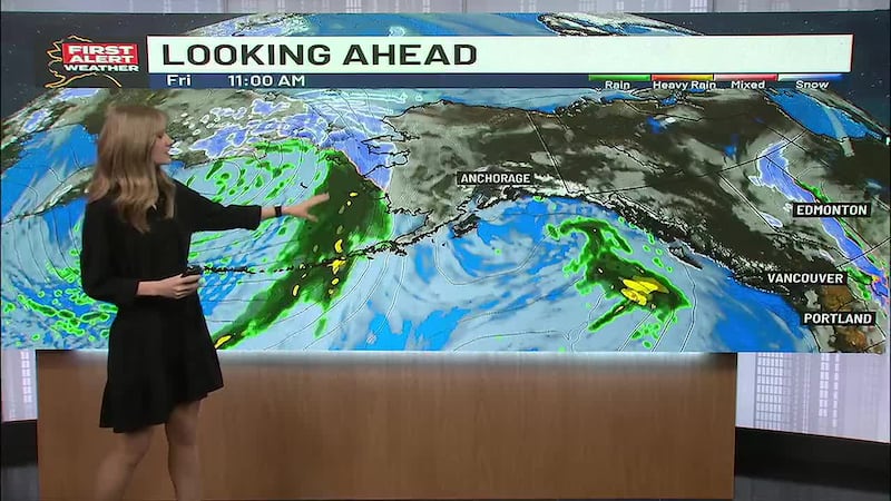
For the extended period, the main theme will be a warming trend in the temperatures. The Arctic cold air mass over much of the mainland will begin to shift eastward into Canada, as the storm track moves into the Bering Sea. This will allow a series of lows and associated storm fronts to move into the Bering Sea. This will have the possibility to slowly dislodge the cold air in place over mainland Alaska, especially over Southwest Alaska.
Starting on Wednesday storms will move into the Western Aleutians while storms form south of the Peninsula on Thursday, moving west into the southern Gulf. Impacts should be largely confined to the Kodiak Island area, as the track keeps any snow further south where the storms and moisture will be present.
The cold air in place across Southcentral should be pulled south into the Gulf behind the storms, so the gap winds will likely be strong on Thursday. Stronger storms move into the Aleutians and should be centered east of Shemya by Thursday night and Friday morning. There could be enough warm air with these storms to potentially bring rain (mainly along the coast) as well as strong winds to the Southwest Friday night.
Storms move into the Alaska Range from the west on Saturday and Sunday. It is too far out to determine whether or not these storms will survive their mountain journey and make their way into Cook Inlet and the rest of Southcentral. Strong gap winds could impact Thompson Pass through the Copper River Delta until Sunday or Monday as the Arctic air mass persists in the area. Temperatures could return to normal as early as Friday in the Southwest and then by Saturday in the Cook Inlet region as storms bring in clouds and warmer air.
Partly sunny skies in Anchorage on Monday with a high of -2 degrees with light winds. Temps drop on Monday night down to -4 degrees.
Partly cloudy skies early on Tuesday in Anchorage before becoming mostly sunny later on while we warm up to 2 degrees for a high. Tuesday night will be mostly clear with patchy freezing fog after Midnight as we drop down to 11 degrees below zero.
Looking ahead, Wednesday we will be sunny with early patchy freezing fog while we warm up to just 2 degrees below zero for a high temperature.
Get more from our mobile apps (
/
), The
on Facebook,
and
or use the hashtags #ktuuWX #Anchorage #Alaska #AKWX #KTUU